I have experience and examples of each type of map and plan:
UNIT PLANS are detailed drawings of living spaces within a larger building. They may include furniture, room dimensions, doors and windows, and fixtures. From penthouse to studio, each plan is to scale and has matching line weights and typographical hierarchy.
UNIT NUMBERING PLANS show that units 100, 200, and 300 are in the same vertical position but on different floors.
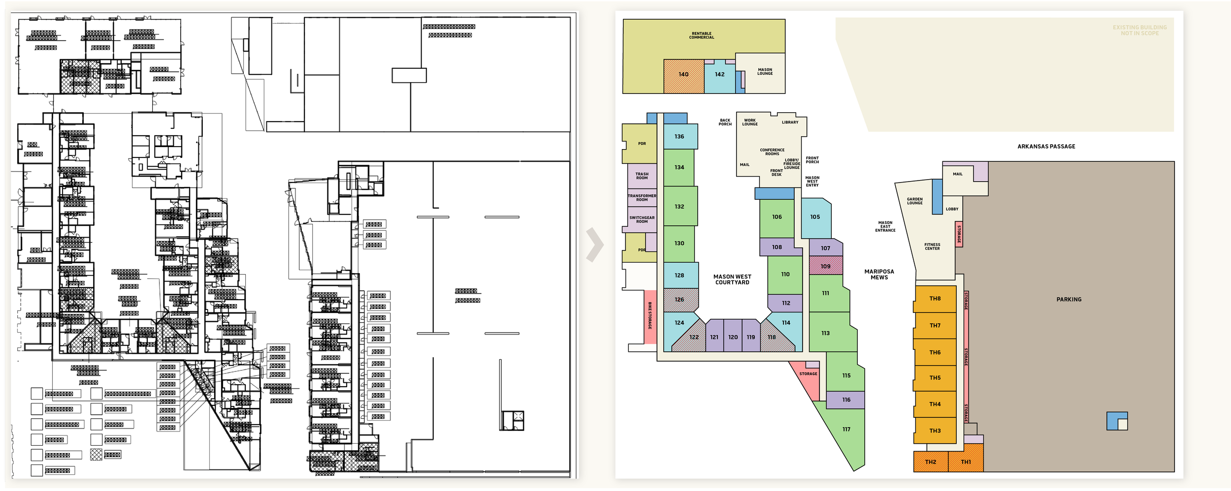
FLOORPLANS show specific spaces on a single floor and highlight tenant amenities such as bike storage, event spaces, gyms, lounges, and other shared facilities. FLOOR PLATES are more simplified, showing the overall layout with less detail and fewer descriptions.
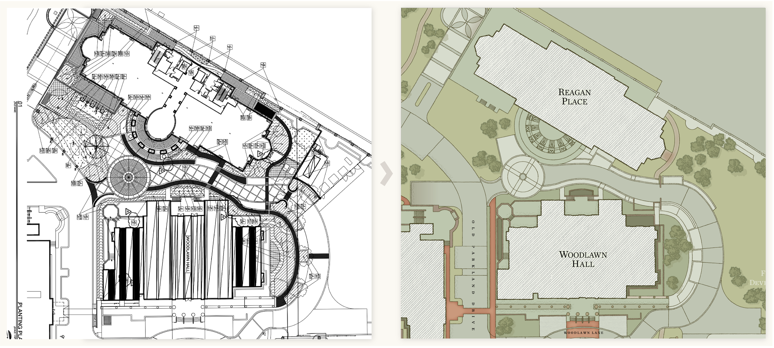
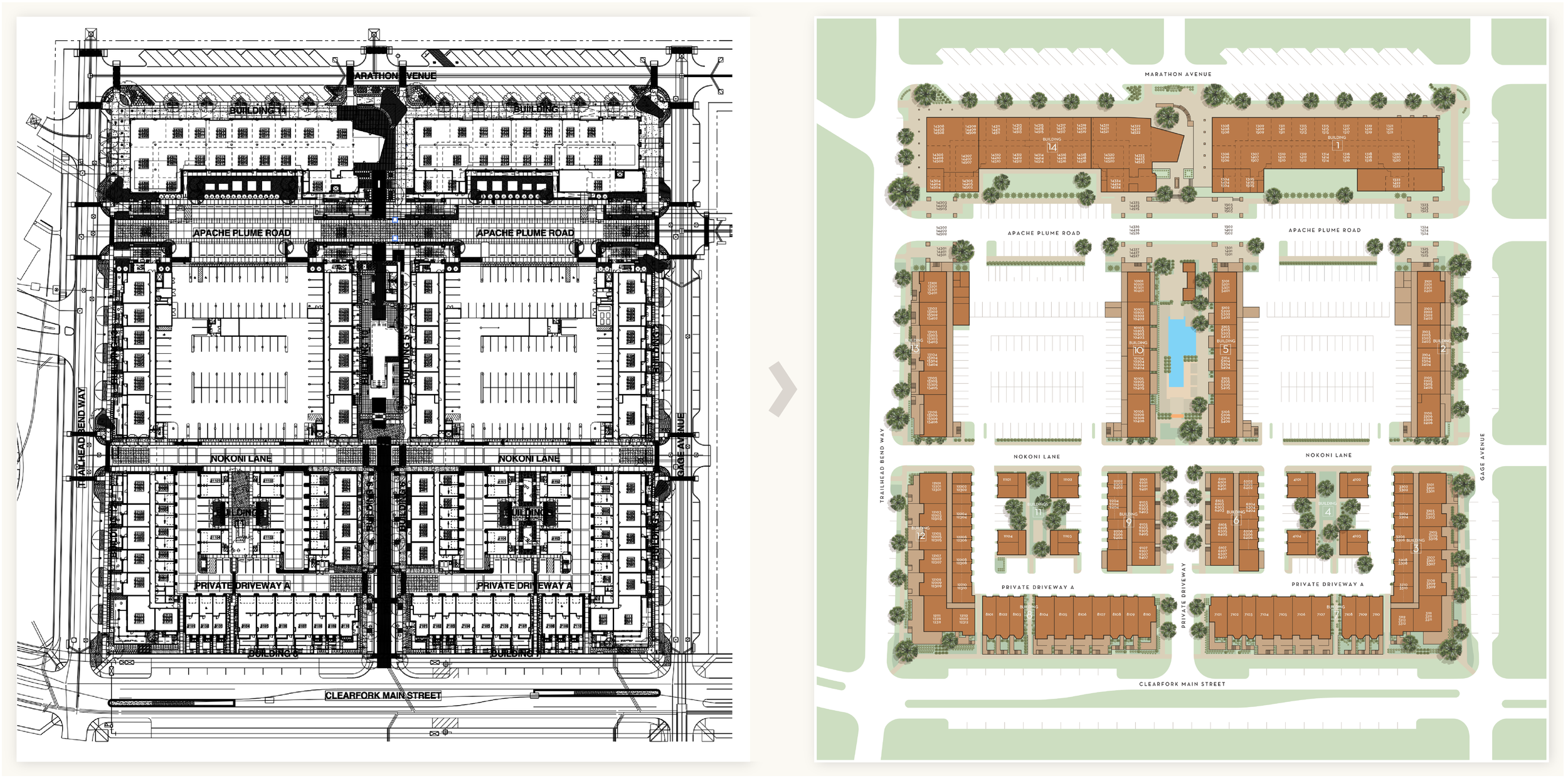
SITE PLANS show the footprint of a building and its surrounding outdoor features such as landscaping, parking garages, walkways, and tenant amenities.
SITE MAPS show simplified features and landmarks of a larger area, like a park, campus or event area. These are often used for wayfinding and signage.
GARAGE PLANS show available parking spaces and storage areas, as well as ingress and egress into the garage.
ELEVATIONS are a direct, front-on view of a building’s exterior, showing the façade and architectural details.
CAMPUS MAPS show locations of individual buildings, facilities, and landmarks.
PARKING and ROUTE MAPS show zones, transit stops, and directional routes.
DIRECTIONAL and WAYFINDING graphics guide people through a building or campus, providing instructions and paths.
LOCATOR MAPS show an overview of services, lodging, attractions and points of interest within a specified area.
CULTURAL and ENTERTAINMENT guides show popular shopping and dining options, sites of significance, and outdoor activities.